Between the equatorial forest and the savannah


THE TRANS-CAMEROON RAILWAY, CAMEROON
475,442 square kilometres in the heart of sub-Saharan Africa, bordering with Nigeria, Chad, the Central African Republic, Gabon, Equatorial Guinea and 402 km of Atlantic Ocean. This is the area covered by Cameroon, the first African nation to reach independence (1960) and the quarter finals of the FIFA World Cup (in 1990). Its climate varies a lot: in fact, some places have a tropical climate, others are semi-arid or equatorial (hot and humid). It features impenetrable forests, desert lands, the savannah, and an extended mountain chain of volcanic origin, whose highest peak, Mount Cameroon (4,040 metres), is among the Earth's rainiest places. A unique scenario crossed by just one railway line: the Trans-Cameroon Railway.
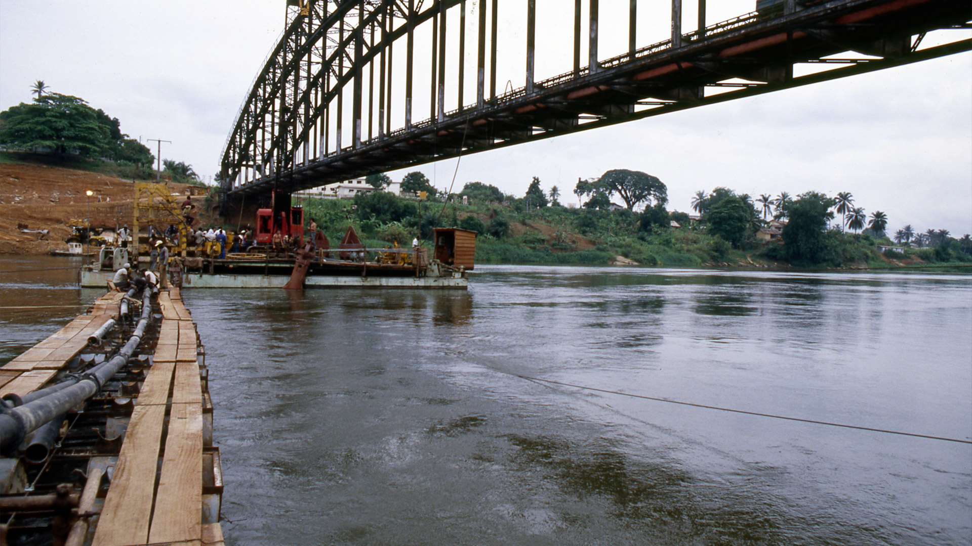
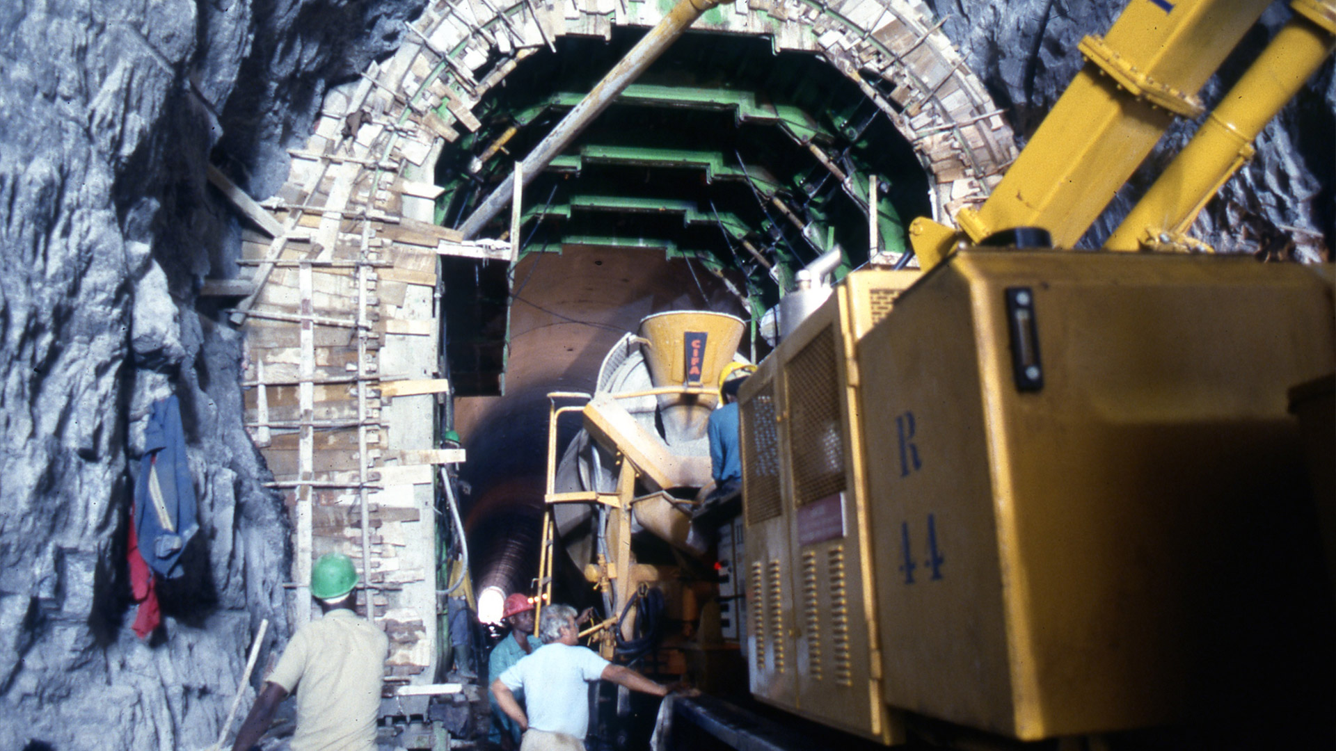
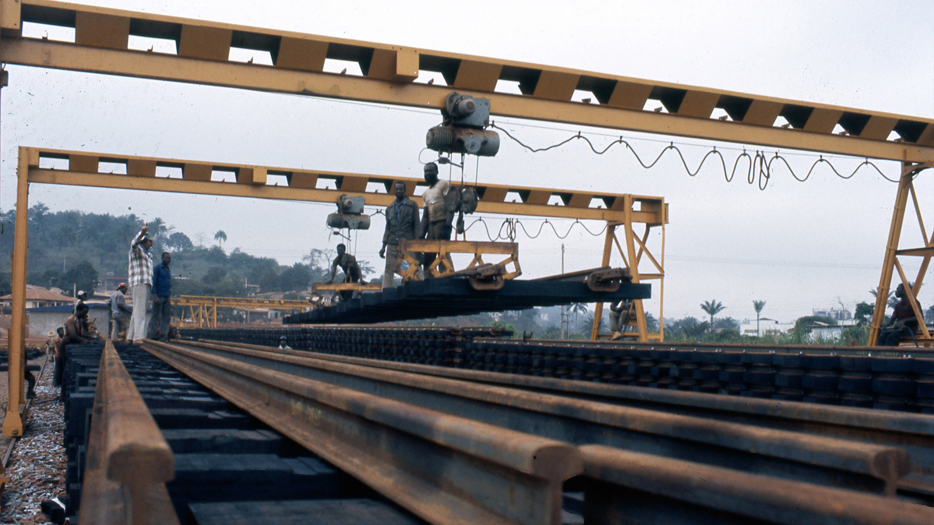
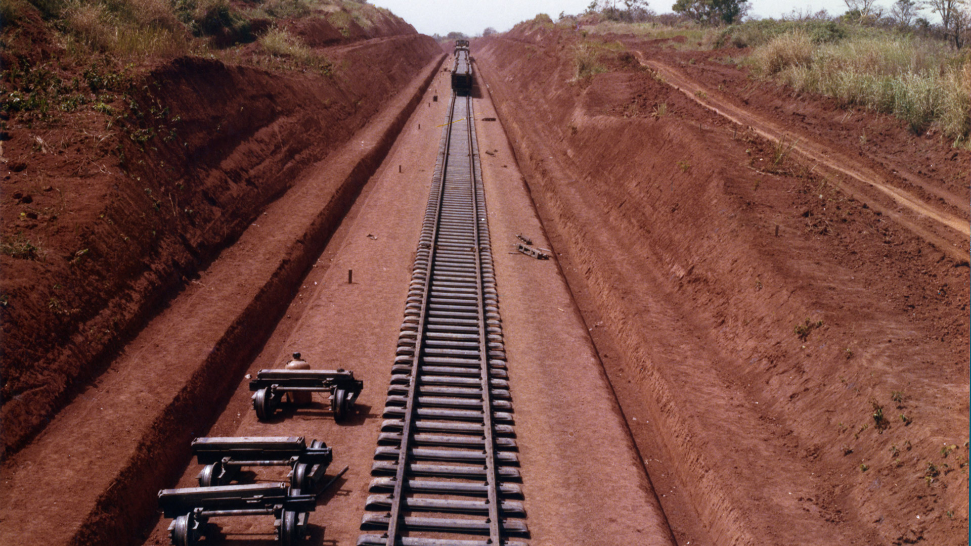
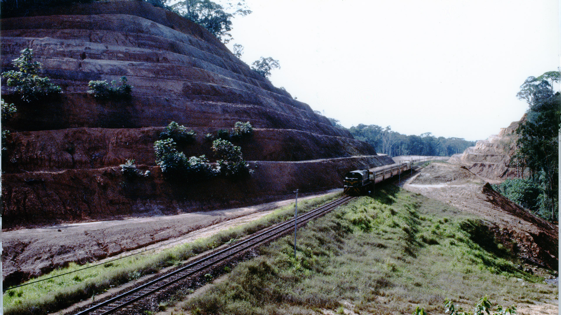
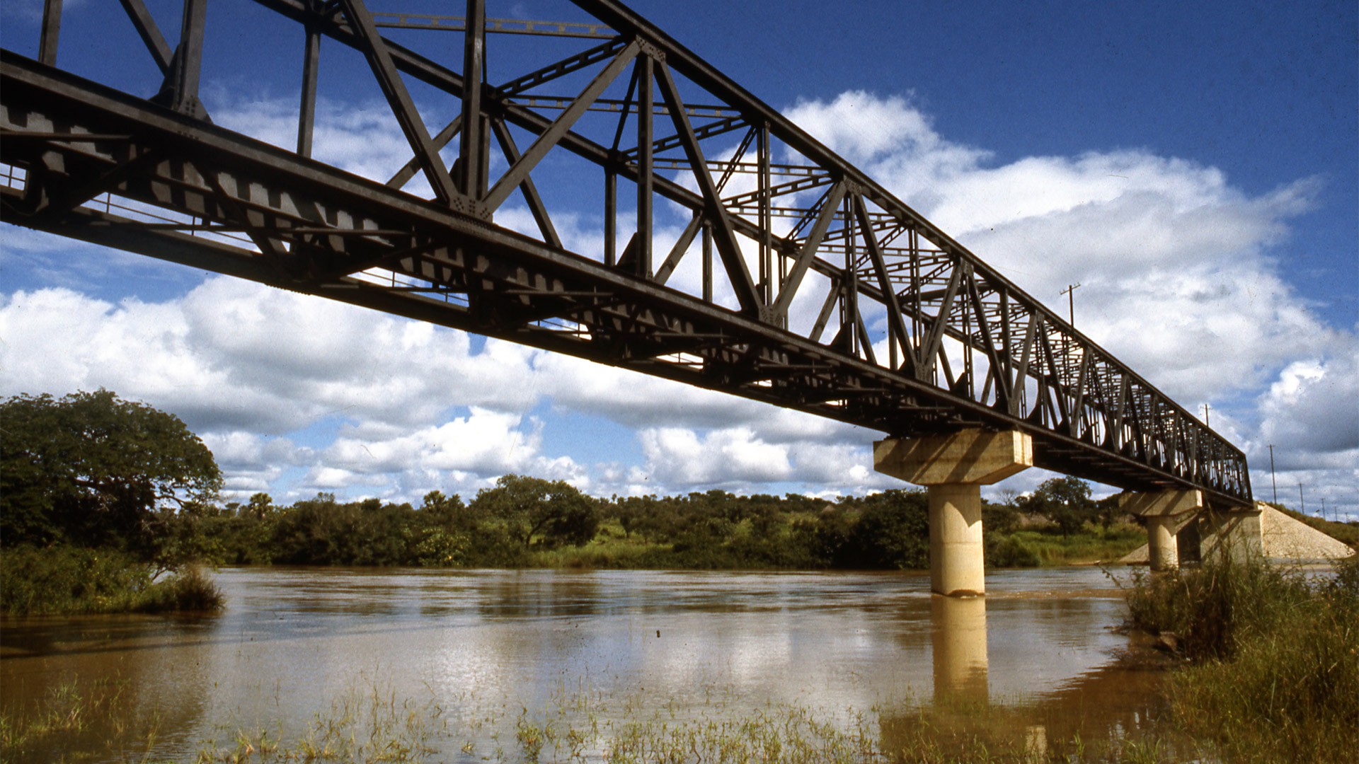
Built between 1964 and 1987, the line connects Doula to Nagoundéré, crossing three quarters of the entire length of the Country: It is divided into two interconnected pieces in the capital Youandé, and it extends for 918 km, along which there are 42 stations, 79 concrete bridges and 26 steel ones. A total of 62,000 tonnes of railway tracks that from the Atlantic coast touch the internal regions, connecting Cameroon to the nearby Countries, also contributing to the industrial, economic, agricultural and political development of the entire area. Huge sections were built in rough areas, covered by dense vegetation or with portions of swamps, the savannah, and by numerous rivers like the Wouri, whose Portuguese nickname "Rio dos Camarões" led to the actual name Cameroon.
Thanks to the Trans-Cameroon Railway, one can also reach or get close to the 7 national parks: just to name one, The Dja Faunal Reserve, A UNESCO World Heritage site, with 409 mammal, 143 reptile, 849 bird, 190 amphibious species, and also a Baka Pygmy village. Their language is one of the hundreds spoken in Cameroon, where for the 28 million of people who live there it is much easier to understand each other if they just speak English and French (the official languages).

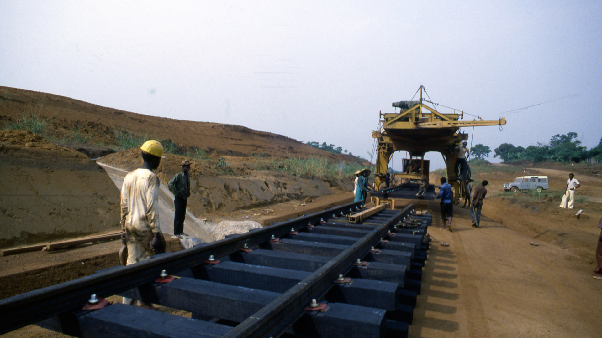
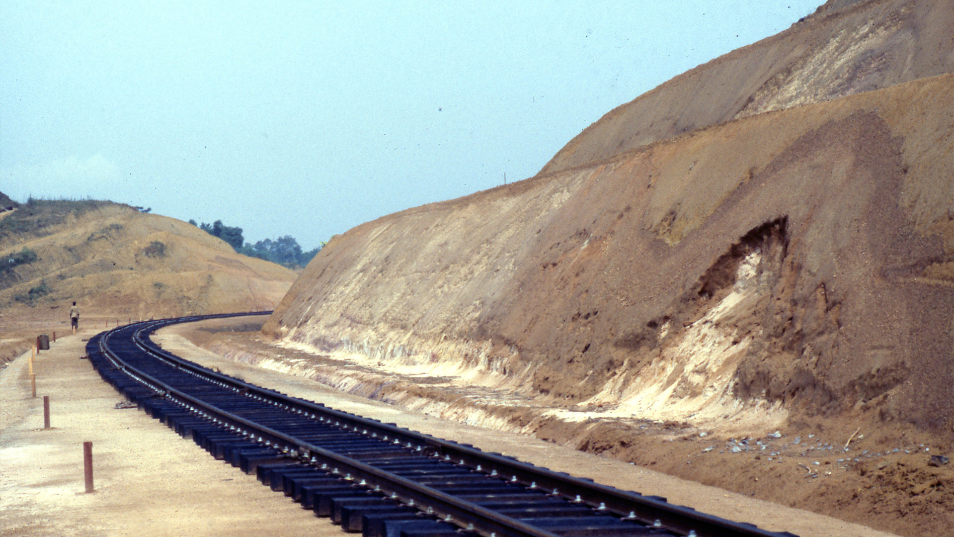
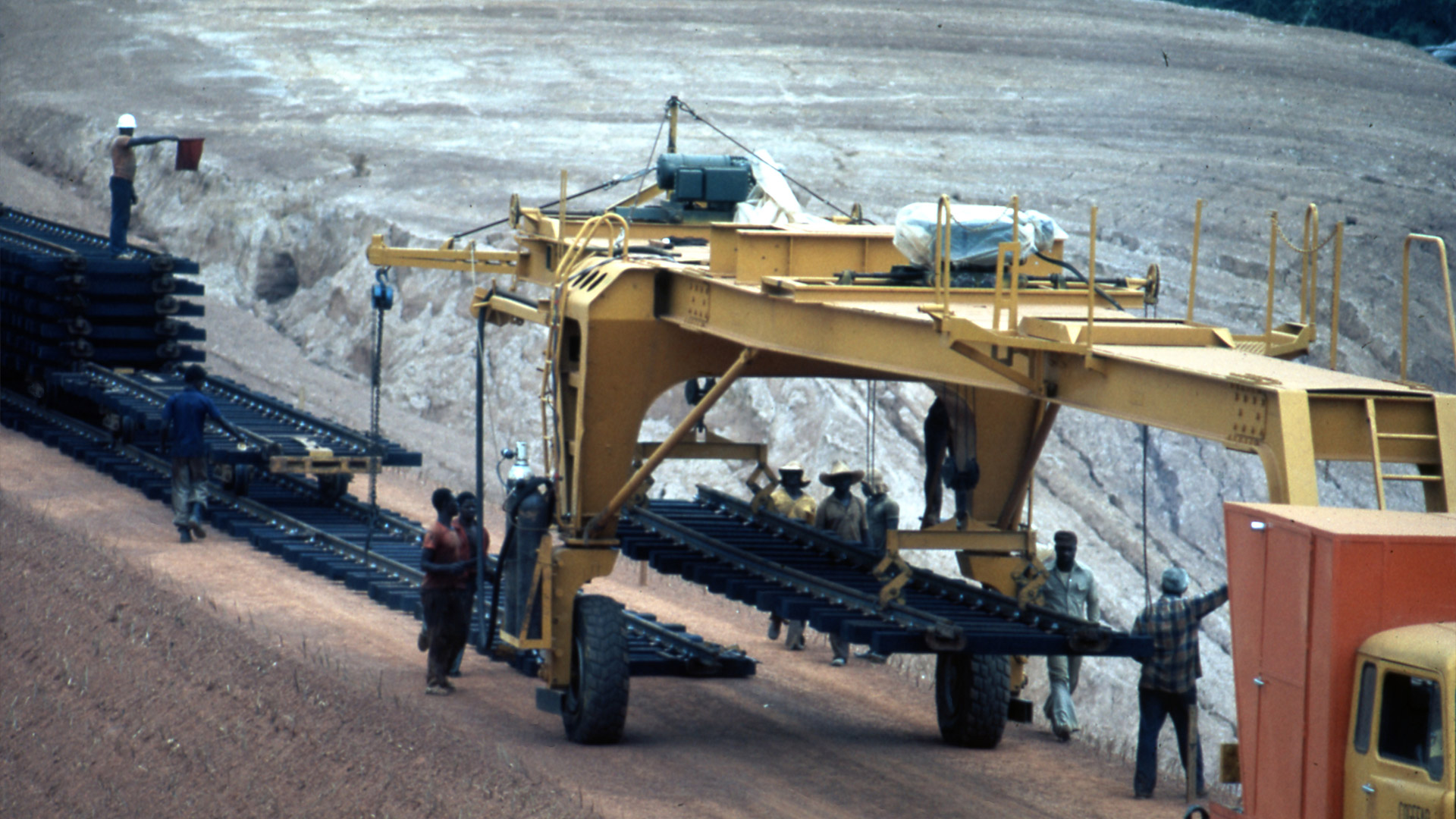


THE WORK AND THE TECHNIQUE
KM RAILWAY LENGTH
CONCRETE BRIDGES
STEEL BRIDGES
T TOTAL WEIGHT OF THE TRACKS
Cameroon Ministry of Transportation
Cogefar, which became part of the current Webuild group
When, in 1960, the Republic of Cameroon became independent, its infrastructures were poorly developed. Due to inadequate roads, the old railway between Doula and the capital Yaoundé, completed in 1927, was of significant importance, but was still insufficient for freight transport and for developing the tourist sector

CULTURAL INSIGHTS


Transcam: la voie de l'avenir

The importance of creating connections
The northward expansion of the Trans-Cameroonian railway has improved freight traffic to Cameroon’s more remote and rural areas, characterized by rugged terrain and limited road accessibility.
Despite a gradual improvement in living standards throughout the 2010s, demographic surveys revealed that 23% of the population in 2021/2022 lived below the official poverty line of $2.15 per day (PPP – Purchasing Power Parity), a figure that has decreased by only one percentage point since 2001.
Of those living in poverty (below the $3 per day threshold), 68.5% reside in rural areas, mainly concentrated in the northern regions, which remain unserved by the railway. This highlights the importance of expanding rail connections to improve conditions for the most disadvantaged populations.
The Trans-Cameroonian railway remains a key asset for trade with Chad — which borders Cameroon’s northern regions. Despite the lack of a direct rail link, Chad was Cameroon’s leading African export partner in 2022, accounting for 3% of the country’s total exports.
Discover other works